Date: June 5, 2013
Day on the Cruise: 51
From: Deltaville, VA
To: Tangier Island, VA
Statute Miles: 28.2
Time: 3.0 Hrs
Cumulative Miles: 1,321.2 SM
On Board: Susan, Chuck, Maggie, Trooper, Peanut
Today we are on an island in the Chesapeake Bay!
 |
| Tangier Island |
 |
| Tangier Island |
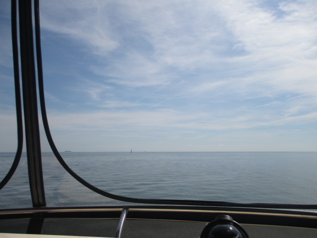
We were up again early this morning. Conditions could not have been better. No wind, clear, and warm. We were headed to Tangier Island!
We got a better look at Dozier's this morning. It really is a great marina and a beautiful place. Hospitality could not have been better.
 |
| Front of the complex |

 |
| Gardens in the front |
 |
| "Blue Moon" in the Calm of Dozier'sAdd caption |
 |
| Maggie is ready to cruise to Tangier Island! |
I tried calling the owner of the one "marina" at the island about 7:30. I talked to him last week and he said to just call the morning we were leaving and he would have space for us. After two tries and getting an answering machine, we decided to head over to the island.
We left Dozier's in Deltaville at 9:05. Once out on the bay, it was like a millpond. Very flat, no swells, and not much breeze. Mr. Parks, the marina owner, called me at 10:00. The chart showed a restricted area between Deltaville and Tangier Island where the military bombed old ships for target practice. He said that they did not do this anymore and the area was wide open. He gave me a route from Deltaville that saved us about 5-10 miles.
 |
| Goodbye Dozier's! |
 |
| Anyone see Tangier Island out there? |
We talked to him again on the VHF at 11:00, and found that we were one of three boats headed for the marina. He talked to all of us and told us about docking.
The Chesapeake Bay is much different from the ICW in terms of navigating. You have open big water all around you instead of channels and narrow passages. There are no markers or buoys except in the main ship channel and some side channels. I experimented a little bit yesterday with using custom created waypoints to get us from Portsmouth to Deltaville. My navigation was way off using waypoints and the autopilot. Today, I tinkered with the settings and found that the magnetic variation on the chart plotter was set wrong. I reset the variation several times and tweaked it by a couple of degrees to get the boat to go right to the waypoint. I nearly ran over two buoys with the accuracy that we were able to get. Yee Haw! I navigated right to the entrance to Tangier Island Harbor using waypoints that I imputed into my chart plotter.
About 5 miles SW of the island, we went through a Menhaden fishing fleet. There were three "mother ships" anchored in our way and several small boats handling nets that they had cast for a fish called Menhaden. The small boats bring the nets full of fish up to the mother ships where they are stored. Pretty interesting. We saw several "pods" of these fishing boats all around the area.
 |
| A "Mother Ship" |
 |
| "Mother Ship and Net Boats |
 |
| Boats handling the Menhaden Nets |
 |
| I think this is a Net Boat Mother Ship |
 |
| "Mother Ship" |
 |
| Net Boat just released by its Mother Ship |
 |
| Yes! Tangier Island ahead. The wonders of electronics! |
 |
| South end of Tangier Island |
 |
| Riding along the Island headed North |
We got to Tangier about noon. Mr. Parks got us tied up, stern to, in a slip. It was a challenge getting backed into the slip with a strong current. Thank goodness for a fully functional bow thruster!
 |
| The Methodist Chruch on Tangier Island |
 |
| Coming into Tangier |
 |
| The Parks Marina |
 |
| Parks Marina following a crab boat |
 |
| Coming into Tangier Island |
 |
| Parks Marina |
 |
| In a slip at Parks Marina |
 |
| Parks Marina |
 |
| Slip Rates |
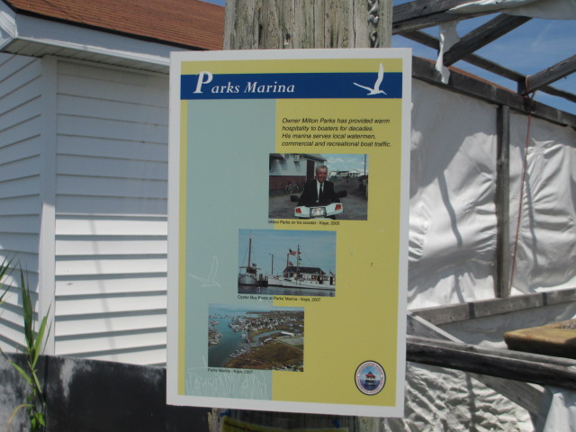 |
| Mr. Parks, Owner of Parks Marina |

 |
| Restaurant where we ate lunch |
Slip rates are excellent at Tangier. It worked out to be a dollar a foot,including power! After getting settled, we set out to find a place to eat lunch, which was our big meal. There are four restaurants on Tangier Island, and we settled on Fisherman's Corner after getting several recommendations. All the restaurants but Crockett's Chesapeake House are only several hundred yards from the Marina. We both had seafood. Our meals were very good, and we would go back.
After lunch, we took a tour of the island in a golf cart driven by Gina who lives on the island. Tangier Island was first explored in the early 1600's by Capt. John Smith. The island was settled in 1686 by John Crockett, and there are plenty of Crockett's still among the island's 500 or so residents. The streets are called "Ridges", so we drove along "Main Ridge". We saw the two churches, the K-12 school that has 70 students, and other historical sites. The island used to support agriculture, but no more. Now, the main livelihood of the "watermen" that live on Tangier is fishing, crabbing,and oystering. There are little white fishing related buildings on pilings all along the waterfront in the harbor. Long white work boats are docked in the harbor and are used by the watermen.
 |
| Downtown Tangier Island |
 |
| Grocery Store |
 |
| Trash Receptacle |

 |
| Post Office |
 |
| Street Scene |

 |
| Street Scene. Only 12-15 cars on the island. Transportation is by golf cart and scooters |
 |
| Crab shacks |
 |
| Tour boat from Maryland |
One interesting thing that we saw was the practice of burying family in the front yards of the houses on the Ridges. It seems as though this practice was adopted long ago to allow family easier access to visit the graves as well as to deter grave robbers.
 |
| Graves in the front yard |
 |
| Graves in the front yard |
 |
| Graves in the front yard |
There is little crime on the island. There is a marine police detail near the marina that has a boat docked here. Anyone apprehended is taken over to the Eastern Shore for handling.
There is also a 2600 ft landing strip on the island.
We noticed the different dialect and accent of the island residents. It is hard to describe, but some say it might be old English. We could understand what most local people were saying to us, but when they communicated with each other, it was not as easy to understand.
Tomorrow we go back to the West across the Bay. We will go about 40 miles Northwest to Solomon's, MD, gradually working our way up the 200 mile long Chesapeake Bay!
Maggie's ear is still infected. Susan is treating it by cleansing. We may try to see a vet tomorrow or Friday in Solomon's. Surprisingly enough, Maggie showed no ill effects from yesterday's rough seas.she eagerly took her place on the Flybridge, waiting for another day of either smooth cruising, or pure bangin' and slamming'! Thankfully it was the former today!!
Thanks for Reading!
No comments:
Post a Comment